
The Eyjafjallajökull Saga, Part Two
Welcome to Part Two of recounting my adventures on Eyjafjallajökull in Iceland (you can read Part One here)! Forget getting attacked by oystercatchers despite not being an oyster, getting exhausted from going uphill, and walking in clouds. Today, we will be facing fresh and even more exciting dangers than before!
It’s Raining Men!

When it’s raining so much that you can’t go out, start painting!
Sunday morning – our second day on Eyjafjallajökull. I opened my eyes. 6:07 am – I always seemed to wake up quite early. I could hear the tent canvas flapping in the wind. The wind was stronger this time; the rain was more aggressive. I really wanted to get out and do some fieldwork but soon realised that going up the mountain would’ve been nearly impossible.
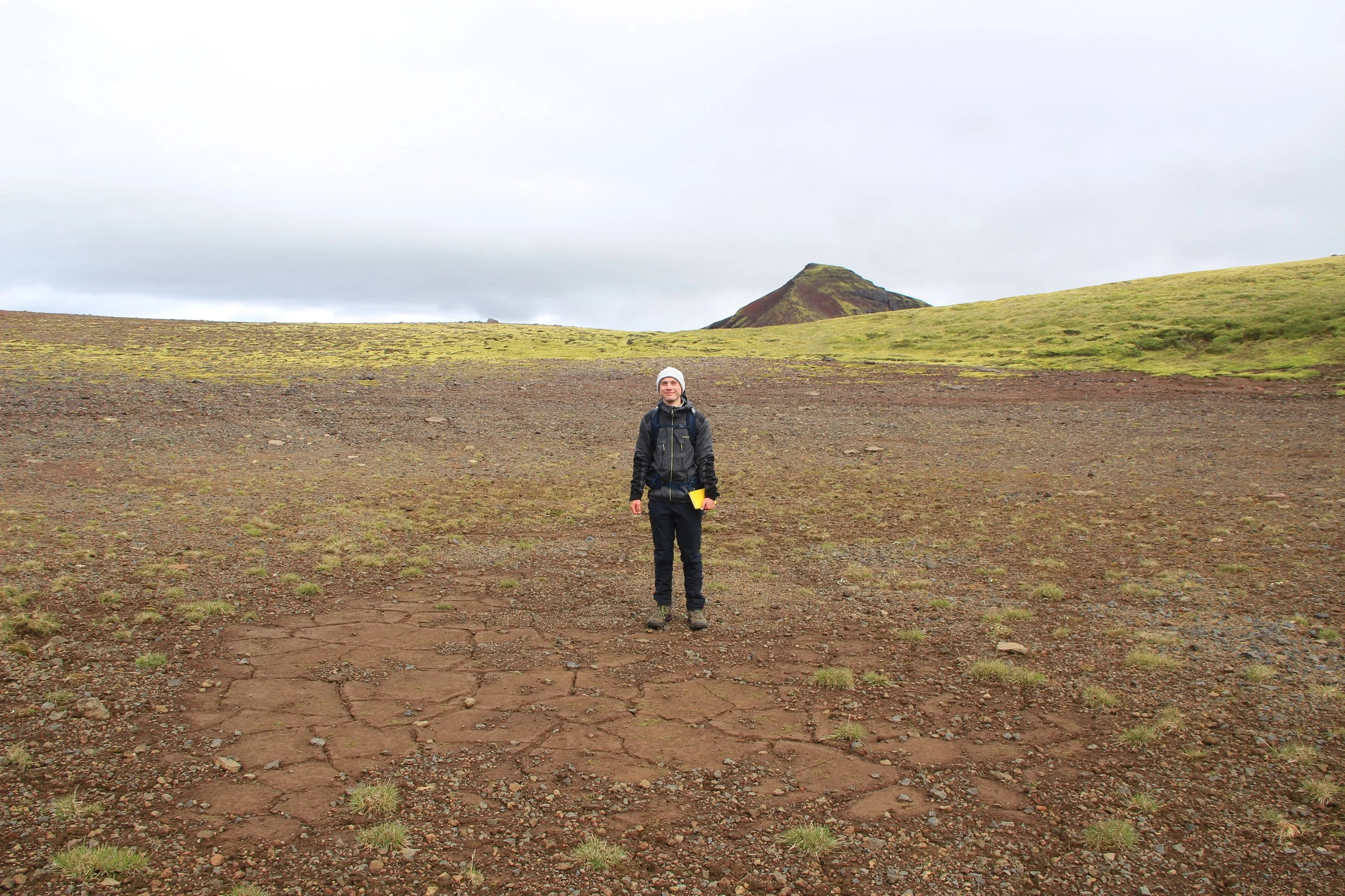
But what about going downhill? I needed to get some data from several outcrops located along the road we used to come here anyway. The wind and rain calmed down by midday, so we decided to wrap ourselves in waterproofs and obtain those measurements. Surely we would be fine.
Spoiler alert: we were not.
The walk started off fine. But just as we were approaching the lowermost point of the journey, the rain picked up again. I quickly measured what needed to be measured and we were back on our not-so-cheerful walk to our campsite. The rain was relentless: it was raining so much that our waterproofs stopped being waterproof. Water was getting closer and closer to my skin, soaking through the five layers I was wearing. I forgot how long the walk uphill felt the first time and it seemed just as long now, even without the thirty-or-so kilogram backpack.
Soaked to the bone, we made it to the camp. I hung some bungee cords in the tent porches to be used as improvised clothes lines. They weren’t very effective but it didn’t matter at that moment. We were just happy to be back in our tent, hidden away from the unforgiving weather. I snuggled in my sleeping bag, praying that the next day would be better. Surely, we would get at least one nice day.
Spoiler alert: we did.
Meanwhile, far away in the Atlantic Ocean, a new storm was brewing. And it was moving towards Iceland, ready to hit the south coast on Friday afternoon. Hit Eyjafjallajökull on Friday afternoon. The Icelandic Met Office predicted that winds could reach up to 26 m/s (about 94 km/h or 58 mph). The tent had already been shaking dramatically when the winds had reached some 16 m/s (58 km/h or 36 mph) – there was no way it wouldn’t fly away during the upcoming storm. I was not going to take any risks. We had to change our plans and decided to leave on Thursday evening instead of Saturday. Gutting, but we better stay safe than be sorry. It just meant I had to cram five days’ worth of fieldwork into three and a half. It was going to be intense.
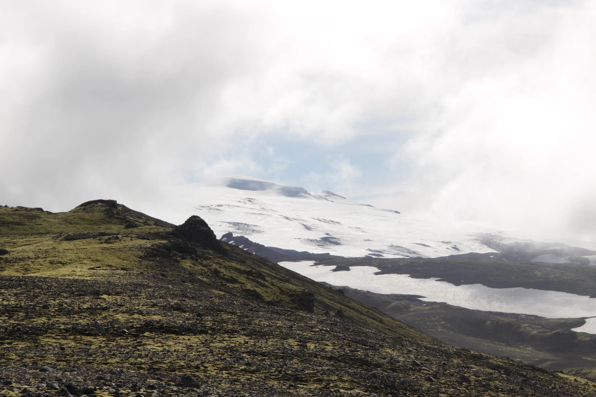
Luckily for us, the wind direction changed overnight. From Monday to Wednesday, the northerly wind brought fresh air from central Iceland. It was colder, but at least it didn’t rain that much and we could see the sun. It’s the small wins, right? We spent every day in the field, trying to get as much data as possible before we had to return to civilisation. I dragged Lindsay nearly to where the margin of the ice cap was. The landscape at around 900 metres above sea level was more rugged: vegetation was replaced by snow, instead of sheep there was only scree. We had to cross several frozen snow fields to get to outcrops. Walking on snow in July (in the northern hemisphere) was quite cool.
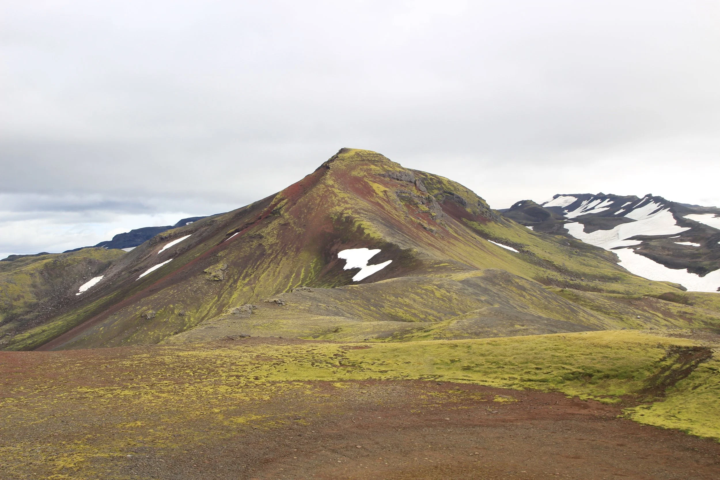
Dagmálafjall, very close to the ice cap (which is hidden in the clouds).
Don’t mess with hyaloclastite, kids
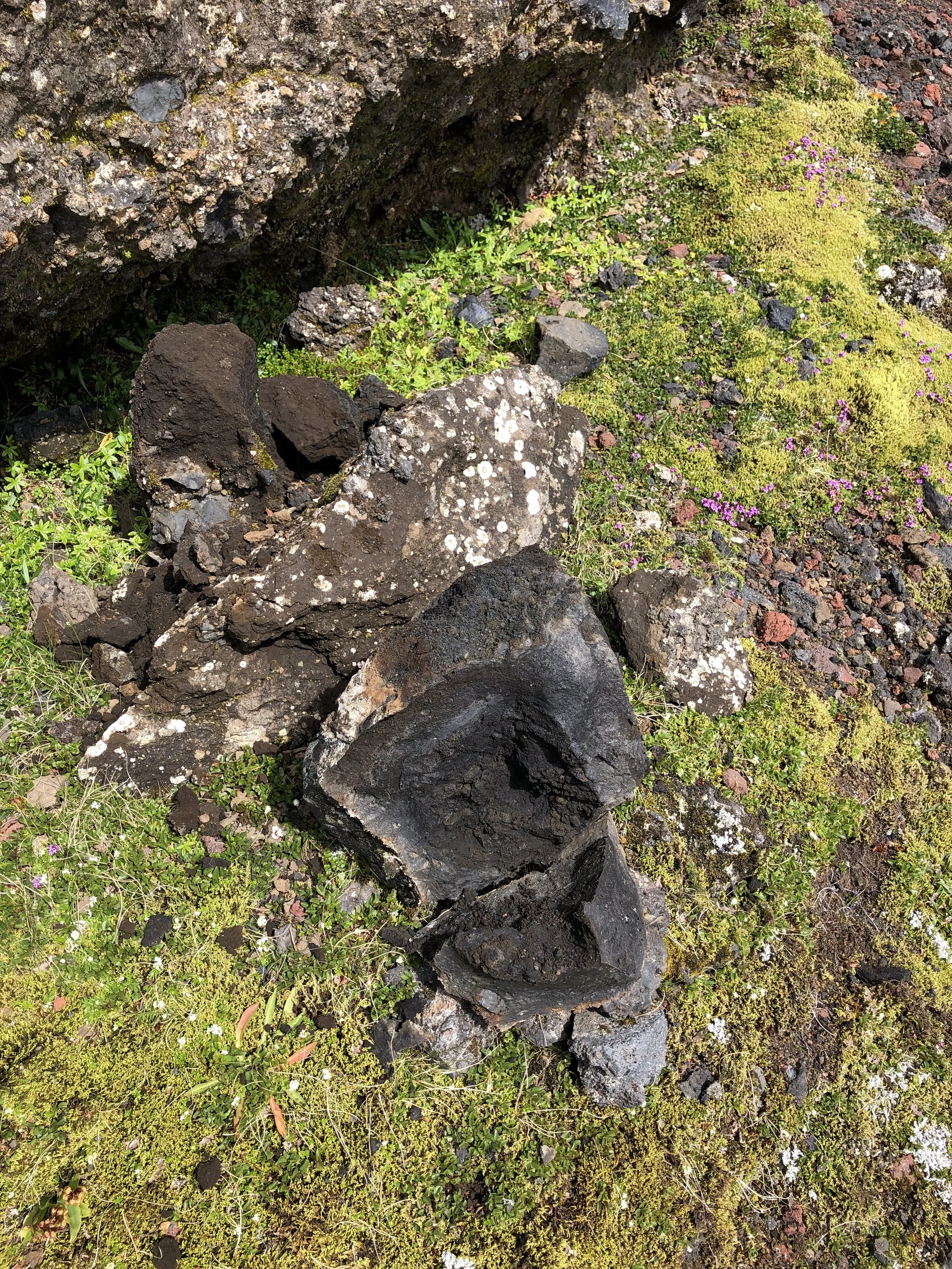
The aftermath of the pyroclastic incident.
Wednesday. The last day in the field. It was a beautiful morning full of sunshine. There was one last outcrop to visit; one last observation to make. Nothing could stop me. I started walking up the steep slope of Arnargilshryggur, trying to avoid the treacherous scree and describe its composition at the same time. Slowly, I made my way to the top, completely in awe of the sheer scale of the ridge and the fossilised lava flows resting on its peak. Nestled below them was an elongated outcrop of brown hyaloclastite with the most perfect black lava bomb embedded in it. It was the largest clast I’d spotted during my fieldwork. I had to see it up close. It was only a metre or so downslope. Easy. I just needed to be careful not to slip. I made a few short steps towards the bomb, grabbing it for support.
The next thing I knew, I was lying on the ground with a sharp pain shooting through my right knee while fragments of the bomb were merrily rolling down the hill. The remaining pieces of the black pyroclast that hit my knee were peacefully lying next to me. I was trying to figure out how bad my injury was. Could I get down the hill? Would I have to call mountain rescue?
I stretched my leg. Ouch. Painful but at least I was able to stretch it. It didn’t seem like it was broken, though it certainly did feel like it. I stood up, more pain flooding my knee. No point looking at the outcrop anymore, I thought. I began to make my way downhill, taking it one limp at a time. I managed to get down with a lot of grunting involved. What a way to end my fieldwork – with a bang!
I got hit by a lava bomb so you don’t have to. What’s the most important lesson learnt here? Don’t mess with hyaloclastite.
Look mum, I’m in a crater!
An Unexpected Journey
Our premature departure had one unexpected consequence: we had to hike some 20 kilometres (12.5 miles) overnight to catch a bus from Landeyjahöfn at 10 am on Friday. We spent nearly all of Thursday in the tent, trying to get as much sleep as possible. At 11 pm, we packed up our campsite, loaded our backpacks (luckily, they were less heavy this time), and set off on our overnight journey. Luckily for us, the high latitude we were at (about 63.5° N) meant it was still light enough to see reasonably well.
We got to Seljalandsfoss around 2 am. The place, usually buzzing with tourists, was completely deserted – not that I’d expect anything else at that time! I rested my hurting knee, ate some sweets, and took pictures by the waterfall. Only 15 kilometres to go. By the time we left the waterfall, the sun started rising again. It didn’t even get properly dark.
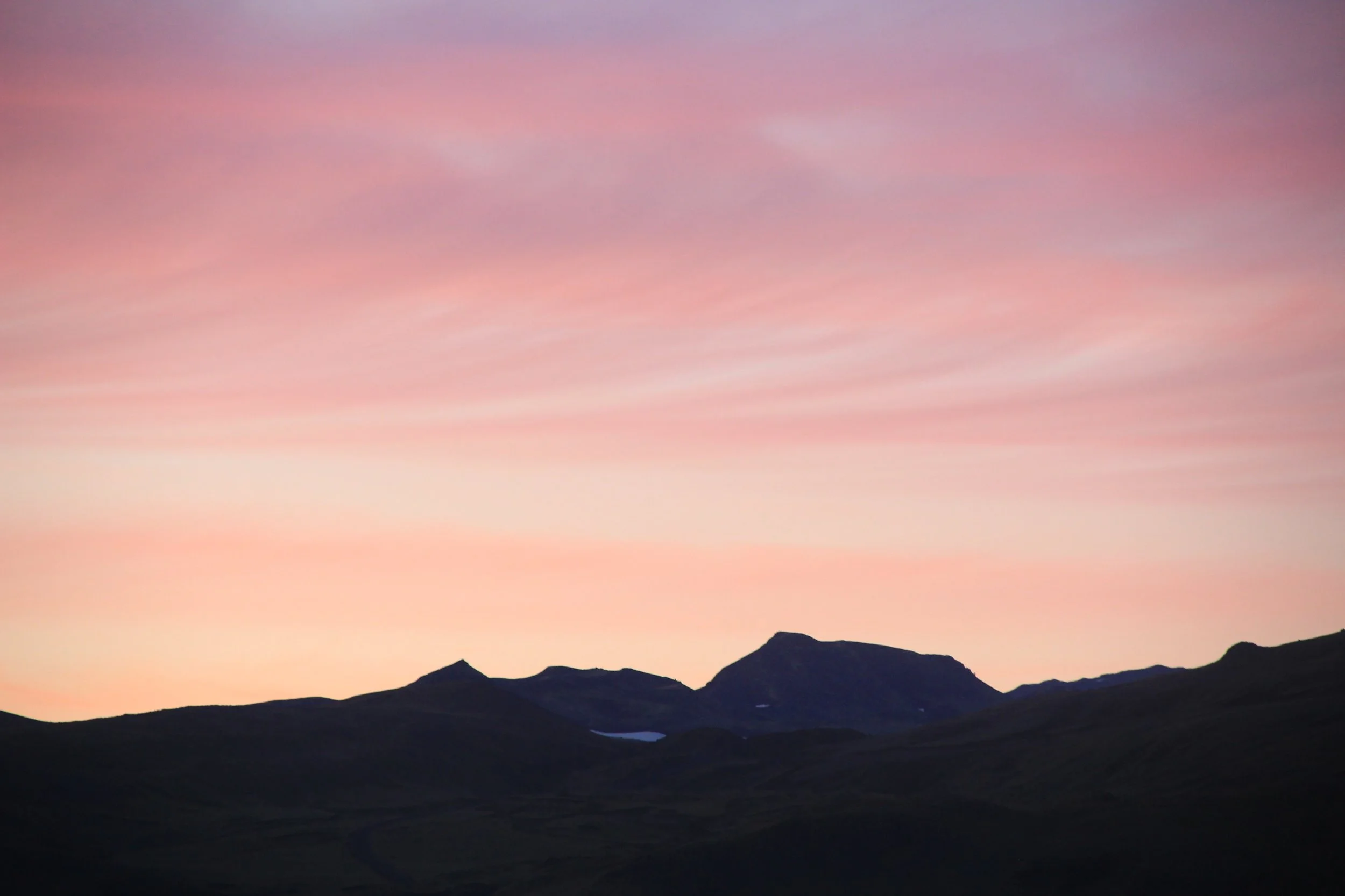
The last stretch of the journey led us across and along Markarfljót, a large braided river that is fed by meltwater from Eyjafjallajökull and Mýrdalsjökull. The first sun rays pierced the clouds. They painted the water and the distant ice cap the most gorgeous shades of orange, pink, and blue, mixing and changing them into brand new hues every minute. I turned around to look back at Eyjafjallajökull, now far away in the distance. The dark mountain towered above Markarfljót and the sky looked like it was on fire. I would’ve painted the scene had I not been so tired. I felt how Frodo must’ve felt when he was carrying The One Ring to Mordor in The Lord of the Rings. Getting exhausted more and more with every step, no end in sight. The only difference was that we were walking away from a volcano. Oh, how I wished that giant eagles would appear in the sky and fly us to our destination! Alas, the only birds around were oystercatchers and curlews waking up and looking for some breakfast in the marshes of the outwash plain. They weren’t big enough to carry us. Shame.
After six long hours of walking, we finally made it to Landeyjahöfn – a tiny port with only one building and a car park. It was 5 am and the sun had risen. Arctic terns were flying above our heads. I collapsed on a bench. A cold wind blew from the ocean. I cried a little. I was so happy to be there. Exhausted but happy.
That was the end of our journey. It only occurred to me at that moment how incredible the past week had been: we camped on an active volcano in Iceland*. That is something you don’t do every day. I feel incredibly privileged that I was given such a life-changing opportunity. Now it’s time to write up my dissertation…

The sky is on fire.
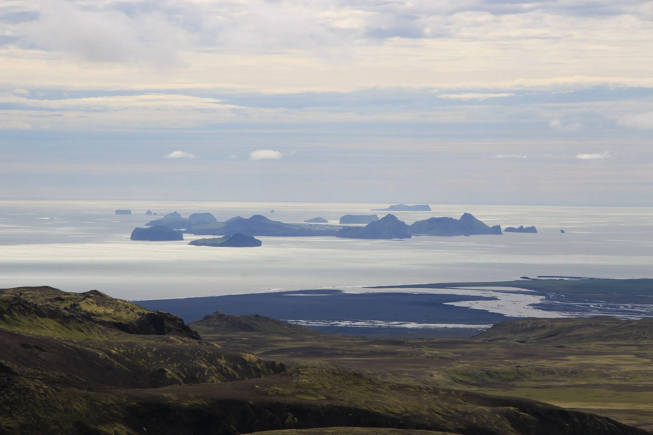
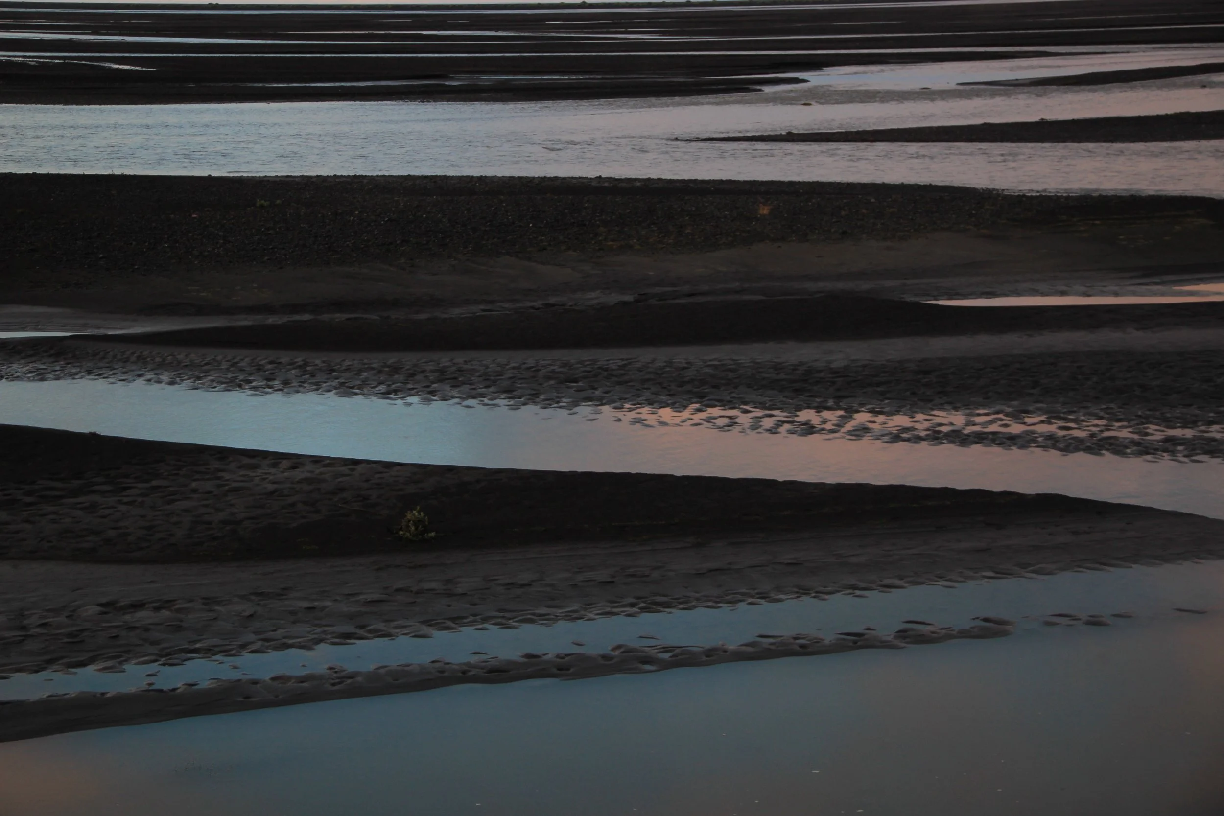
Left to right: the ice cap peeking through the clouds; the field site as seen from Markarfljót; Vestmannaeyjar; Markarfljót patterns.
GLOSSARY
braided river – a sediment-laden river consisting of a network of channels separated by little islands (braid bars)
hyaloclastite – a beige or brown rock that forms when lava rapidly cools down and is fragmented when erupting underwater or beneath a glacier
ice cap – a mass of ice that covers an area smaller than 50,000 km squared
lava bomb – a type of volcanic fragment larger than 64 mm, created by an explosive eruption
pyroclast – a fragment of lava which was erupted explosively; pyroclasts include volcanic ash, lapilli and volcanic bombs
*DISCLAIMER: Wild camping in Iceland is illegal. We were camping on private land and had written permission from the land owner.